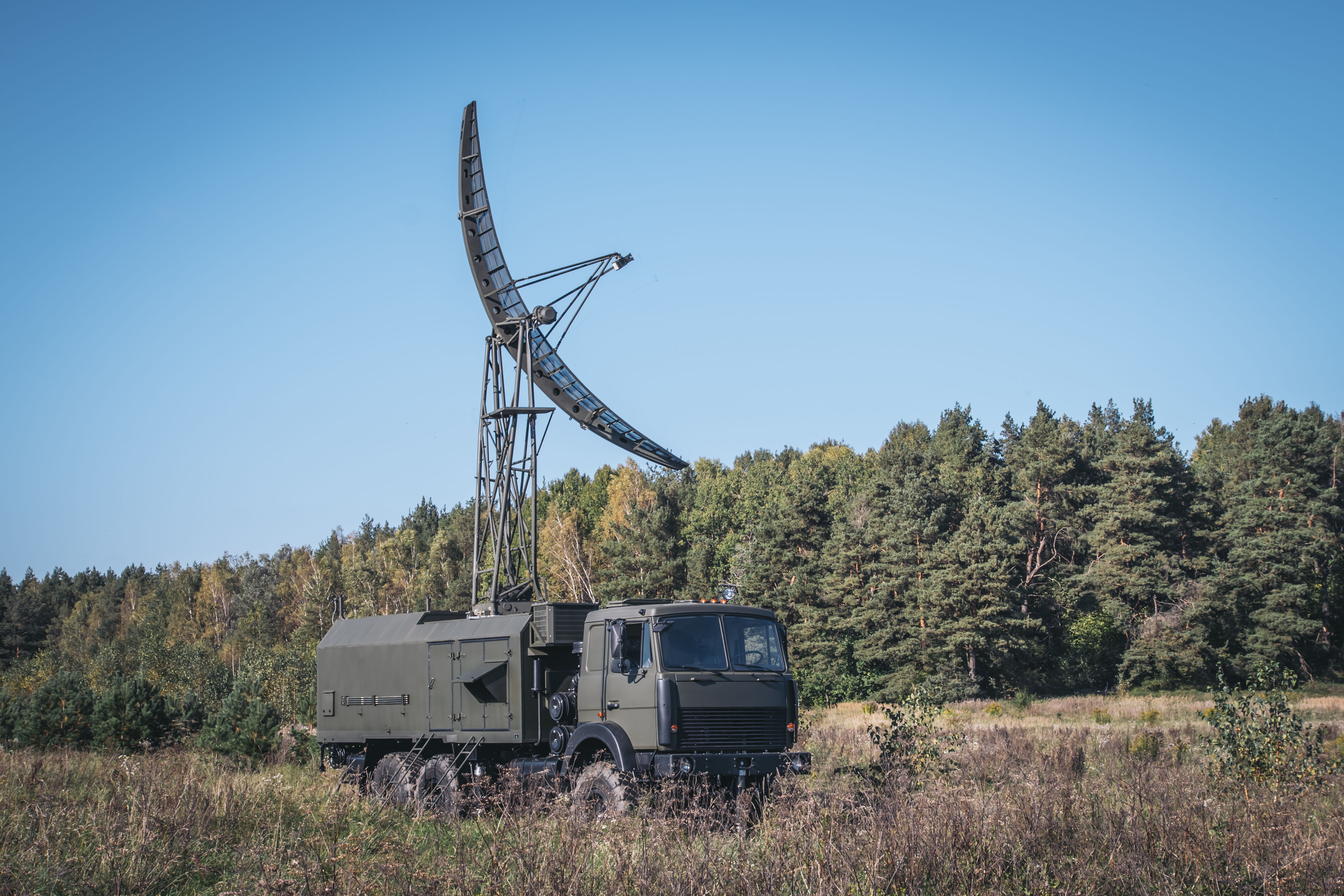
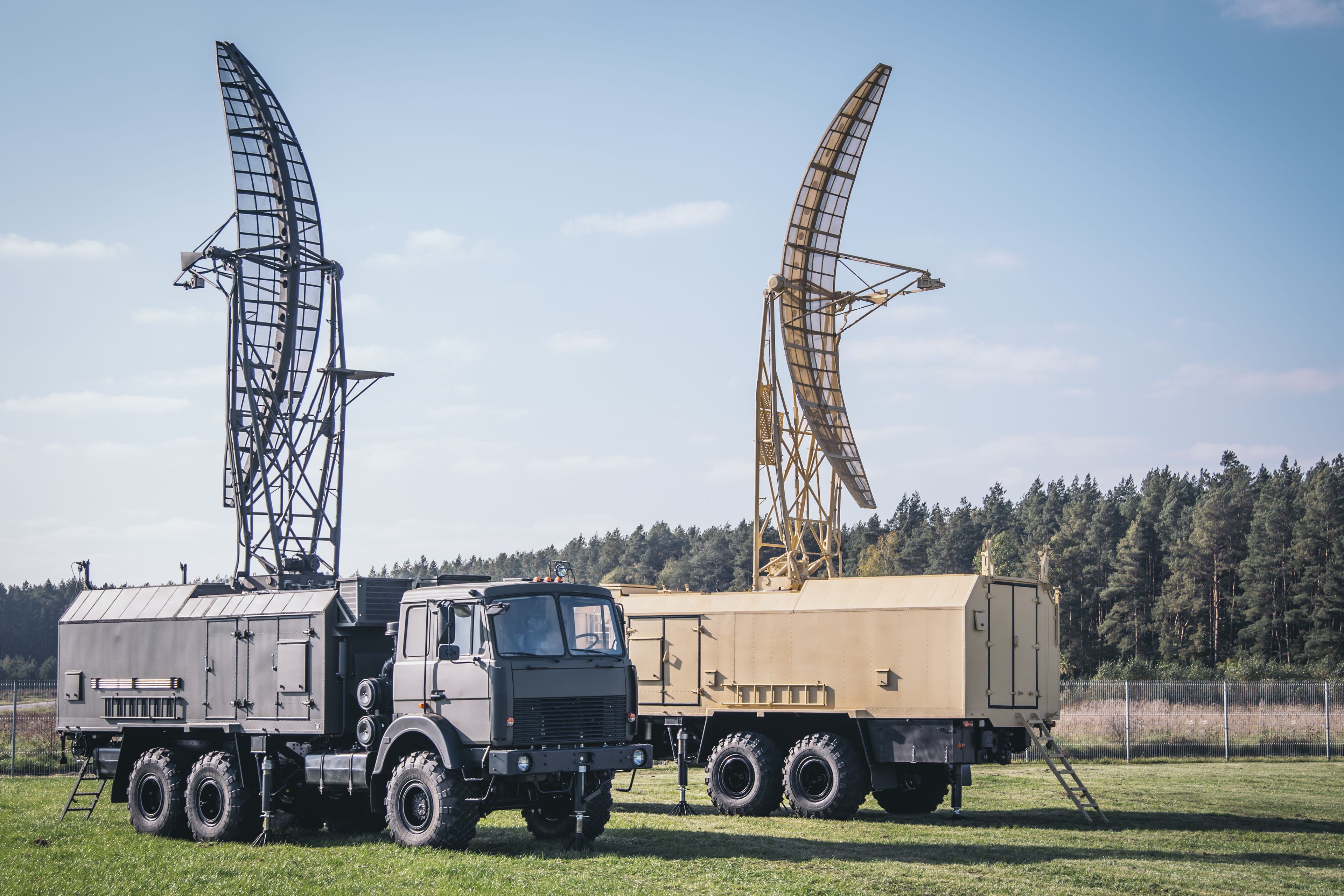
PRV-16ML
- Home
- Radar systems
- PRV-16ML
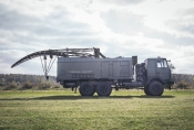
Mobile height-finder PRV-16ML is intended for measurement of aircraft altitude from target designations provided by interfaced radar or automated control system and bearing of active jammers. By default PRV-16ML distributes data in ASTERIX format. Along with two-dimensional range finders (such as upgraded P-18/P-19 etc.) PRV-16ML forms the back-bone of 3D Radar Complex. System is offered as the upgraded follow-on to the prototype, analogue PRV-16. PRV-16ML can be easily interfaced with surveillance radars and command and control centres such as P-18ML, P-14ML, MARS-L, AMCP "Module", etc. Advanced digital technologies of radar signal processing and solid-state components have allowed to improve performance characteristics and jamming immunity, electromagnetic compatibility, decrease power consumption.
Main functions:
- acquisition and processing of target designations from interfaced surveillance radars, command and control units;
- automatic detection and measurement of position (azimuth, slant range, elevation), height calculation;
- data distribution in ASTERIX format;
- displaying target designations, air situation and weather formations at technical workstation;
- manual target designation by operator, automatic height measurement for verbal output;
- automatic detection and bearing (in elevation) of active jammers, data distribution in approved protocol;
- semi-automatic levelling, automatic topographic positioning based on “Navstar” GPS;
- automatic technical monitoring and diagnostics.


- interfacing capability with existing control systems;
- automatic target detection at specified azimuth, elevation (height) measurement and data distribution to radar sensor (command and control unit);
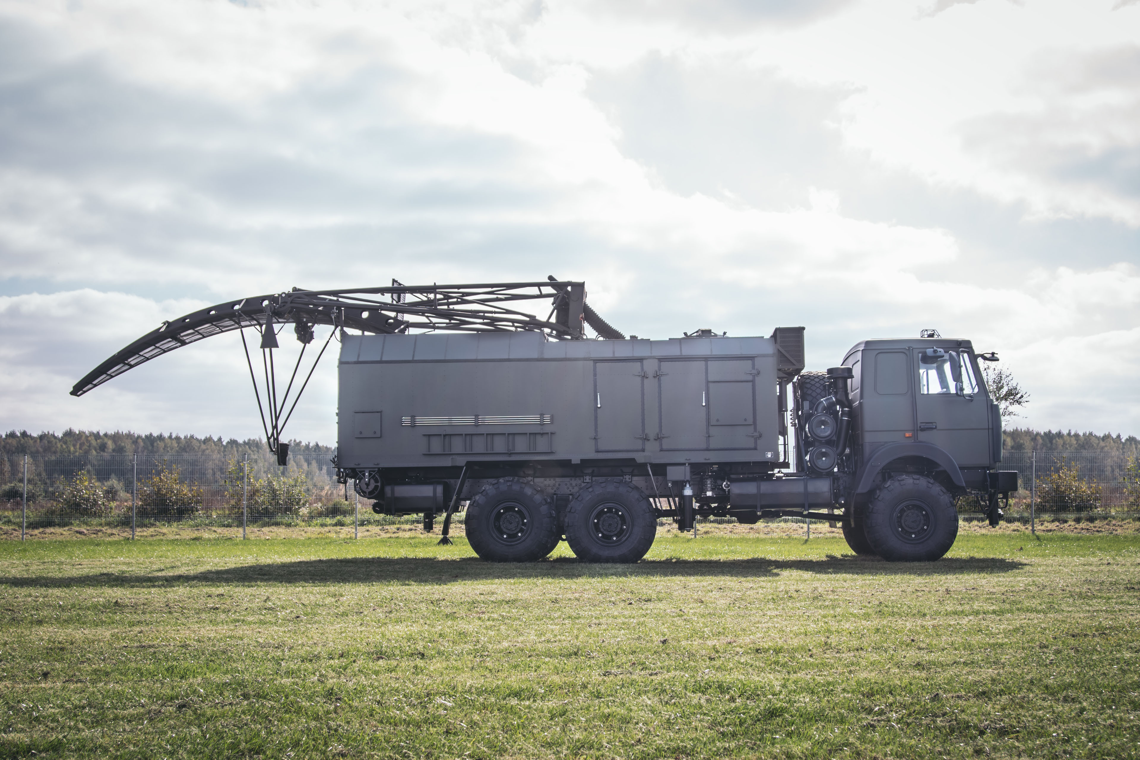
- increased mobility due to arranging and accommodating all equipment on a single vehicle, automation of levelling and terrain positioning;
- fully independent field operation: built-in power generators to back up 380 V, 50 Hz industrial mains;
- replacement of all outdated equipment with new one not requiring adjustment;
- minimizing hardware operations in favour of software implemented solutions;
- built-in diagnostics and technical monitoring system.
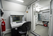
- hardware cabin or truck chassis;
- antenna waveguide;
- transmitter;
- receiver;
- antenna servo drive control;
- data processing, displaying and distribution system;
- power supply system;
- communication system;
- levelling system;
- positioning and orientation system;
- temperature control system.
PRV-16ML is equipped with advanced semi-automatic levelling system. Levelling accuracy of ± 2’ is achieved.
|
Parameter |
Before upgrade |
After upgrade |
|
Operation limits: |
|
|
|
From 100 to 45000 m |
From 100 to 45000 m |
|
From -0.5° to 30° |
From -0.5° to 30° |
|
Detection range for a target with RCS of 2.5 m2 on a site with zero take-off angle at the altitude of: |
|
|
|
35 km |
40 km |
|
70 km |
80 km |
|
110 km |
120 km |
|
from 3000 to 45000 m |
170 km |
210 km |
|
Accuracy in 80 % of measurements: |
|
|
|
1000 m |
300 m |
|
2° |
0.5° |
|
250 m |
150 m |
|
Resolution: |
|
|
|
1500 m |
300 m |
|
3° |
3° |
|
0.5° |
0.5° |
|
Altitude detection time for a single target |
10 s |
9 s |
|
Altitude measurement mode |
manual |
automatic |
|
Crew |
5 |
4 |
|
Time of deployment/stowing down on site |
15 min |
15 min |
|
Start-up time from warmed-up power units |
3.5 min |
3.5 min |
|
Travel speed on unpaved roads |
35 km/h |
35 km/h |
|
Power consumption (380V, 50 Hz) |
15 kW |
10 kW |